Skip to content
 Foundation Models for Geospatial Analytics (Collaboration with NASA and IBM) - In this project, we showcase the application of Prithvi Foundation Model in segmentation, image classification, and gap filling. Trained on approximately 175,000 multi-spectral and multi-temporal image chips from Harmonized Landsat Sentinel-2 (HLS) imagery across the Contiguous United States, Prithvi FM demonstrates exceptional performance, achieving results similar to or better than the baseline models with a significantly smaller sample size.
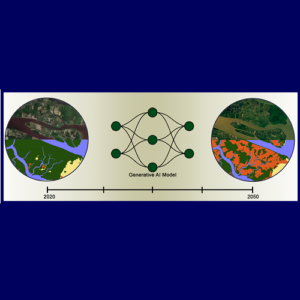
 Land Cover Change Modeling using GenAI (Collaboration with WashU) - This project leverages generative AI models to project future land cover changes using historical satellite imagery and land cover maps. By exploring three novel AI modeling approaches, we aim to enhance the accuracy in predicting environmental transformations. The project addresses critical geospatial challenges by supporting sustainable land-use planning and climate resilience strategies. Anticipated outcomes include […]
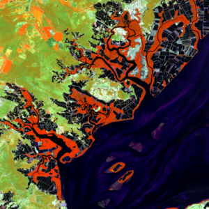
 Pond Aquaculture and its Impact on Mangroves and Other Coastal Wetlands - Since 2013, Clark Labs has had a succession of grants from the Gordon and Betty Moore Foundation to map the development of brackish pond aquaculture and its impact on mangroves and other coastal wetlands in 17 countries in the global tropics. Mapping is based on Landsat 8/9 OLI imagery pan-sharpened to 15m resolution, supplemented with Sentinel 1 RADAR and Sentinel 2 multispectral imagery. Maps have been produced for 1999, 2014, 2018, 2020 and 2022.
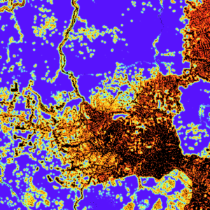
 Risk Mapping for REDD (Collaboration with Verra and TerraCarbon) - Since 2022, Clark Labs, in partnership with TerraCarbon, has worked with Verra to develop a methodology for the predictive mapping of the risk of unplanned deforestation in tropical jurisdictions containing REDD projects. This has now been accepted as the VT0007 Unplanned Deforestation Allocation (UDef-A) tool. The methodology provides a benchmark modeling approach that establishes a spatially and quantitatively explicit mapping of expected future deforestation for jurisdictions that may contain multiple REDD projects. A jurisdiction is typically a country, or a state or province for large countries. The tool also provides the means for incorporating alternative empirical models and for their evaluation against the benchmark. Work continues with the development and testing of an open-source software implementation (UDef-ARP) and toolboxes for ArcGIS and QGIS.
BESbswyBESbswyBESbswyBESbswyBESbswyBESbswyBESbswyBESbswyBESbswyBESbswyBESbswyBESbswyBESbswyBESbswyBESbswyBESbswyBESbswyBESbswyBESbswyBESbswyBESbswyBESbswyBESbswyBESbswyBESbswyBESbswyBESbswy
Notifications


